Saturday, September 22, 2012

DRIVING TO THE ARIZONA HIGH DESERT


FRIDAY

I left Barstow, California this morning for the 350 mile drive to Flagstaff, Arizona and a three day visit with my sister-in-law, Carol. I will be on I-40 the entire day.  Actually, I-40 will take me within an hour of my home in Tennessee.  Of course I won’t stay on it for the entire way, but it’s an interesting thought.  I see signs for Route 66 as I drive.  I could travel some on that route, for historical purposes, but it won’t really change my view. I’m expecting a desert drive today, but there are good hills on both sides of me that add perspective to the desert. 

I had a hard time going to sleep last night because my brain kept right on working after the lights were out.  I kept trying to put all the pieces together:  pieces of this trip, pieces of my life, pieces of my Mother’s life.  I almost got up to write my thoughts down, but then I would never get back to sleep…and I n beed sleep for a long drive in the morning.  When I woke this morning all the brain workings of last night could not be resurrected enough to be coherent. Of course.

Last night was my first night in a hotel on this trip.  All the other nights, when I haven’t been staying with relatives and friends, I’ve stayed in bed and breakfasts.  I’ve always wanted to take a trip where I only stay in B&Bs so this trip was my perfect opportunity.  I see B&Bs as a way to meet people while I am traveling and to have someone to eat breakfast with and share a few stories.  I see it as a way to add warmth and personality to my travels. B&Bs are a bit more expensive than hotels (I limited myself to $130/night), but I only needed reservations for twelve nights so I forged ahead with my reservations.

The B&B experience has been interesting.  In at least three places, I have been the only person staying the night, which makes breakfast really awkward.  Generally, the owner will sit down and chat while I eat – but it’s odd knowing that someone is cooking breakfast for just me.  It blows my whole purpose of wanting to share breakfast with other people who are also traveling. Breakfast is usually served at 8:00 or later so an early departure is not always possible, or it at least complicates things. In a couple of places, the male owners who were also preparing breakfast had questionable personal hygiene and because of my years in the food business, it raised all kinds of questions for me.  In another location I found used washcloths in my bathroom and only family-size soaps and shampoos so it made me question other housekeeping details. One man was a professional chef, turned B&B and construction business owner.  I saw his kitchen.  I didn’t like what I saw.

When I got to my hotel last night, I realized I had several conveniences I had not had in the B&Bs:  controllable room temperature, a desk to work on, adequate plugs for my electronics, and good light. There are fewer unknowns at a hotel, though I have to admit I have been in a couple of hotels in the past that didn’t meet my standards.  I guess in some areas I am not as much of a risk taker as I thought I was.  I did what I set out to do, but I have come to understand the B&Bs have not been the best part of my trip.  What has always been “I really want to stay in B&Bs for an entire trip” has become “been there, done that, don’t have to do it again.” In the future I will stay in hotels whenever possible – one more decision made.

I am running with the trains again, as I drive across the desert, with the mountains off in the distance.  I’ve missed the trains the last three days while I’ve been in Yosemite and the surrounding mountains. My fondness for trains extends to boats and barges on the rivers that parallel my route.  People and materials are moving across this vast country, all day, every day. I lack the words to explain why the trains and boats are important on the journey.  Perhaps it’s the varied means of transportation, perhaps it’s the distant companionship in my momentary geography, perhaps it’s just a point of interest that captures my attention.  I wonder about where they are going and what are they hauling and how long is their journey.

I must be close to Needles, California because all of a sudden I see a row of about twelve billboards, one right after the other, on my side of the highway.  There are a few on the opposite side as well. I’ve been driving for about two and a half hours and these are the first billboards I’ve seen today – not that I had missed such sights – I just didn’t realize there weren’t any until now. About 5300 people live in Needles and the valley is quite green, obviously the result of irrigation.  The Colorado River, though small, runs through this area, providing boating and recreational opportunities. The town name “Needles” sounds like it’s right out of Gunsmoke.

At 11:30 it’s 96 degrees in Arizona – a big change from the cold mornings and cool days in Oregon. Small spindly cactus are beginning to replace the sagebrush.  These cacti have ten or twelve shoots spraying from the ground and are five to six feet high. There are multiple signs for washes along the road – places where the water runs when there is water.  All of them are dry today.  One was named The Holy Moses Wash.  Of course there was no water to be parted so we could walk across, but I couldn’t help but smile at the name.

At Kingman, Arizona I spent some time in the Route 66 museum, watched the movie, and learned about the history of this route.  I actually tried to soak up this place for Fred.  It’s amazing what a mother will do just because she’s thinking about her son, knowing he would love a place like this. I learned that Andy Devine was from Kingman; I read his biographic sheet which brought many early memories. 

Everything here looks very southwestern:  tile roofs and beige stucco houses.  When I leave Kingman I see more mesas in the landscape and hills covered with large round reddish orange rocks. As I climb out of Kingman I reach an elevation of about 5000 feet and everything is green – the sagebrush is green, the ground grasses are green.  I thought all of today would be desert driving so this greenness is a nice surprise.

Farther down the road, at Williams, Arizona I saw a sign for the Grand Canyon Railway Depot.  The Grand Canyon is only about 60 miles from here and this is the interstate turnoff for it.  Off to my right, I see an Amtrak passenger train, about ten cars long, waiting at the station.  This is the first passenger train I’ve seen on the entire trip.  I am wondering now where you start to get here on a train. I’ll have to research that when I have a little time.  Another option for another trip. 

As I near Flagstaff, all the trees are evergreen, the ground is spotted with yellow-flowering plants amongst the grayish green grasses, all as foreground to the peaks in the distance.  It makes for lovely driving, that never tires the eyes or the spirit. Now that I am at a higher elevation, the temperature has dropped to 76.  The Arizona Divide is 7355 feet.

I am anticipating several days of working with Carol, having important conversations and exploring the grandeur of these mountains.


Thursday, September 20, 2012

YOSEMITE & BEYOND

THURSDAY

I no longer know where to start.  Ever day the scenery seems more fabulous than the day before and I lack the words and the photographic ability to adequately show you what I am experiencing.  So I will skip the superlatives today and let the pictures speak for themselves.


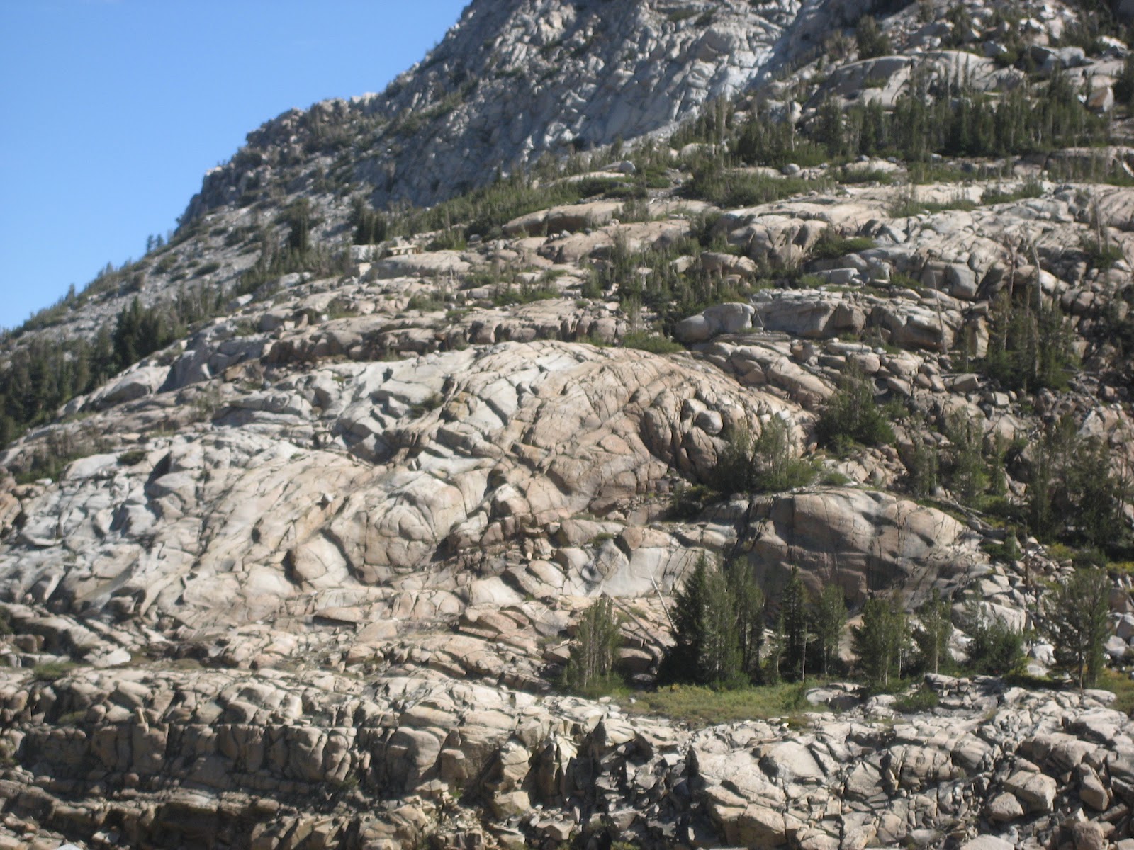
rocks at Olmsted


Lunch at Tanaya Lake
I spent the morning driving over Tioga Pass in Yosemite, then I exited the park at the east entrance and headed south on 395 toward Barstow where I will spend the night.  Again the day is perfect -- three weeks of perfect!!  The elevation on this pass exceeds 10,000 feet.   My advice on this road is to make sure you have food with you so you can take advantage of great lunch stops.  Food is only available at one location on the entire road.  I will also advise you take advantage of every potty opportunity -- you never know how far it is to the next glorified outhouse.

 At Toulume  Meadows I saw horses in a corral and signs for horseback riding.  There were also riding opportunities in Yosemite Valley.  I'm thinking I may plan the next road trip around trail riding -- seems like a good idea.  I'll just have to get my legs and tush toughened up before such an adventure.

When I exit the park, a historical market says this road was initially a wagon road for miners but was open to automobiles about 1915.  The road was then redone in the 1960's to accommodate increased automobile traffic.  The road clings to the sides of the hills and is girded up in some places by steel beams. After dropping several thousand feet into the valley, the terrain becomes very arid.

 Past Mammoth Lake area, which is a ski resort village, I am surrounded by mountains on all sides -- some bare, some covered with trees.  I am surrounded by mountains on all sides.  The mountains on my right (west) are very jagged and pointy and steep.  On my left (east), they are more rounded and bald.  They look like the "sleeping fat men" -- that's the way I described the hills along the Columbia River when I was a child. In front (south) the mountains are sueded brown. It is clear to me where "purple mountains majesty" comes from; the mountains really do take on a dark purplish hill when the sun and shadows are just right.  The valley ahead of me has purple stretches as well.  This is truly a watercolor day to capture the scenery. The valley floor is very green, the grasses are greenish yellowish brownish color.  There is a strip of pink area out there, but it doesn't look like anything blooming. Then there are some white places.Some of the sagebrush is very dry  but some has obviously benefited from some water. Where are my paints when I need them?


The mountain in my rearview mirror is slate grey and wrinkled like an old person's skin.  Old wrinkles don't go in just one direction:  lines go up and down, other lines go across, some go kind of slanty.  I know those wrinkles because my mother's skin was kind of like that in her later years: wrinkled all over with lines going in several directions in the same places.  It wasn't just her neck, her whole face was wrinkled.  These mountains are like that, covered with great texture.  Like an old person who has lived a lot of years, these mountains have lived well and weathered a lot of storms.

At 3:30 this afternoon I still have more than three hours before my hotel.  I spent more time than I realized this morning, stopping and enjoying, but it's o.k.  I should make it to Barstow before dark.

Today, and yesterday, the drive is totally new to me.  While I expected Yosemite to be spectacular I was not prepared for all the wonderful mountains after I left the park.  Bishop, CA looked like a really cool town where I could have spent a lot of time.  I made a quick stop at a Dutch bakery, ogled over all the pastries, and only bought one for my breakfast tomorrow morning. 

As I'm driving, I wonder how my friends would like these mountains.  If their standard is tree-covered mountains these certainly do not fit that description.  If majestic is their criteria, then they would love these. I was expecting more desert in this part of California but that has turned out not to be true.  Once I picked my scenic routes before I left, I haven't really used my tour books much since then.  I've had plenty to do and plenty of signs to read so I haven't felt the need for more information.  All of my AAA books are still in their tote bag. I moved them from the back seat to the cargo area last week.

I came very prepared and maybe that's why the trip has gone so well.  But then I think maybe it's because I was open to let the trip be what it was going to be. I expected some difficult days or some extra long days and that  hasn't happened, except for the tire issue in Montana late one night.  I've had perfect weather, great scenery, and I haven't minded the drives at all.  How can  a person tire of such great scenery?  I'm going to have to return one day.  This is the stuff that feeds my soul, the grandeur of it all.  I'm grateful for good roads that allow me to see all of this and the time to travel and the new car and the fact I can afford such a trip.  I don't live too high on the hog when I'm traveling.  I don't need to, because the high on the hog is the scenery.  It's not where I am staying or the lavishness of the hotels or the B&Bs.  Those are just a place for me to sleep until I can get back outside, driving amongst this wonderful creation, a creation that changes hour by hour.  I can't say it changes minute by minute, because these mountains are so large it takes a long time to get passed or through them.  Time is irrelevant here.  There's no reason to rush.  There's no reason I want this to be over.  Although I'm ready for whatever comes around the next corner, and I've been surprised many a time on this trip. I feel terribly grateful that I can do this, that I have the confidence to do it, and that I have the support of family and friends.

The naysayers have been very, very few and I believe there are a few people who wish they were traveling with me.  That would have been fun too, but it would have been a different trip.  I'm not sure  anyone else would have enjoyed spending time with my family, not that they aren't wonderful people, but it's different when you are not a family member and it changes the entire dynamic.  Next time I might take someone with me, but I haven't wished someone was with me, I haven't been lonely.  I met three motorcyclists this morning from Germany at the B&B.  They said they had a mid-life crisis last year and decided they would be in the U.S. exactly one year later, so they were biking through southern California for ten days. We had a very pleasant conversation over breakfast.

At Big Pine, gas is $4.29.  Outside Yosemite it was $4.89; inside Yosemite it was $5.00.  And for those of you who are interested, when I got to Barstow the odometer says 5,195 miles and I am getting 27.4 mpg.

I had forgotten that out here in the West, ranchers often use cattle guards (strips of metal set into the pavement with spaces between) to keep the cows off the highways.  I had also forgotten, that once the cows learn about cattle guards, stripes can be painted on the highway that look like cattle guards and are equally effective. Pretty cool.

About twenty-five miles from Barstow I change highways.  For the first time since I left home I am traveling east.  The sun is setting behind me and I'm realizing from here on I will have the sun in my face in the mornings.  That will be different.  In the afternoon the sun will be behind me. The sunset that will be pushing me home and closing out my days until I get home.  I'm thinking about that tonight because the sun is glaring in my rear view mirror as it slips beneath the mountains.

Another tree for Fred


Wednesday, September 19, 2012

YOSEMITE PARK

WEDNESDAY

I left Grass Valley this morning heading towards Yosemite National Park.   I chose the scenic route rather than the quickest route, which means I drive on two-lane roads through lots of small towns on California Highway 49 toward Corona and Placerville. At the beginning of this road the sign said 8% grade.  The road is very twisty and I'm driving right down into the canyon. I love roads like this. It won't be a fast drive today, but my purpose is not to get to Yosemite quickly.  My purpose is to soak up the scenery as I go.  Carolyn told me this morning I am driving through the heart of the gold country, so I am getting some idea of area where the gold rushers did their mining.

Typical gold mining town
In Placerville there are a number of Victorian homes, painted in the usual variety of colors, typical of that time period.  It's a rather picturesque place nestled against the hills.


Serbian Orthodox Church

On down the road I am in Calaveras County where Mark Twain wrote about the jumping frogs. In the town of Angels Camp I saw a junior high school named after Brett Hart and I am realizing I may have Twain and Hart and the frogs all mixed up.  I need to do a little research to get all of this straight in my mind. It's been way too long since I have thought of such things.  A little farther down the road a church catches my eye because of it's architecture -- it seems out of place here.  The sign out front says "Serbian Orthodox Church."  I know from Bill and Carolyn there were a lot of immigrants in the area so I guess it makes sense that it is here.

Also in the area is Carson Hill -- a mountain that has been terraced for mining.  Gold was discovered here in 1854 and the mine was then known as the Morgan Mine.

At Robinson's Ferry there's a high bridge for road traffic, but ferry service was first established here in 1856 to move goods and animals and people from one side of the river to the other.

As I continue winding through the mountains, up and down the canyons, I saw a sign for Mark Twain's cabin.  I must have passed the turnoff because I never saw another sign indicating where to turn. Then an historical marker a little farther on says the cabin is in one mile.  According to the marker, the cabin is a replica with the original chimney and fireplace. "Here on Jackass Hill, the young Mark Twain, as a guest of the Gillis Brothers, 1864-1865, gathered material for "Jumping  Frog of Calaveras" which first brought him fame and for roughing it."  Nearby is a sign for the Brett Hart Trail.  This road is so crooked and narrow with no shoulders so I really can't stop and check things out.

Sometime after I turn onto highway 120 and I am about forty miles from Yosemite, I see a sign to turn off my air conditioner for the next 8 miles.  There's no explanation.  I suspect it is to keep vehicles from overheating as they climb the mountains. This road is very crooked and goes right up over the top of the mountains.  I can barely glance at the scenery because this road is a challenge to drive.  Another sign warns drivers to watch for vehicles coming in the opposite direction.  There are no guard rails for the most part, except on steep blind corners. Occasionally there is a shoulder.  I can see across the canyon where there is a similar road snaking up its side. I first thought when I get to the end of the canyon the road will cross over and go down the other side, but that turns out not to be the case.  At the top, there is a crossroads, with roads going in four different directions -- not what I expected at all.  I pull into the parking lot of a tiny cafe to take a break from the tedious drive and to view the road below.  Not knowing what the drive is like ahead, I decide to enjoy a rootbeer float and watch the cars and trucks winding their way up the mountains. I suspect the elevation here is about 5000, though I've seen nothing to verify that.

After my brief stop on top, the road continues, but is not particularly steep or crooked.  I discover I am in the little town of Groveland where I will stay in the Bershire Inn Bed and Breakfast tonight. I check in early to give myself time to explore part of Yosemite before it gets dark.  The inn is about twenty miles outside the park.

After I stop at the Yosemite entrance gate, the road winds among the hills, much like I drove through all the way from Grass Valley.  I drive for about ten miles, and frankly I am not impressed.  And then...and then I turn a corner and there is the first huge stone mountain in the park.  Totally awesome!!  My plan is to drive the loop in Yosemite Valley, which I should be able to do before dark.  However, a flashing sign says a certain section of roadway will be closed between 5:30 and 8:00 tonight.  I pull over and check my map.  It turns out the roadway that will be closed is the only park exit road that will take me to the B&B.  I check my watch and figure I can drive thirty more minutes and then I will have to turn around and leave the park.  I certainly don't want to get caught for several hours. A couple of miles down the road I see two park rangers stopped at a viewpoint.  I whip in there to find out about the road closure.  They assure me it will probably only be closed for an hour.  When I tell them my driving plan, they tell me to go on and there shouldn't be any problem.  As it turns out they are blasting rock and they want to make sure it doesn't fall on the roadway.
Yosemite Valley


Yosemite Valley is fabulous.  I open my sunroof which gives me a great view of hunks of rock rising from the valley floor.  The only other way to see them in their entirety is to get out of the car for an unobstructed view.   The rocks and cliffs look just like the photos in National Geographic, only better.  Photos don't do them justice -- just like all the other landscapes on this trip.  There are a few crazy drivers out here who decide to stop in the middle of the road to take pictures or who decide to come down my lane to get to a viewpoint on my side of the road.  Thank goodness for slow speed limits.

At one stop on the Yosemite Valley loop trail there's sign that says President Theodore Roosevelt and John Muir camped here to discuss saving America's wilderness.  While I've heard about these meetings, it's very different to stand in their place looking at these gigantic rocky mountains.  I'm so glad they made such decisions so many years ago.

Because I love old historic hotels I located the Ahwahnee Hotel towards the end of Yosemite Valley.  I had hoped to stay there but it didn't work out, so dinner tonight seems like the next  best thing. The dining room is gorgeous, requires reservations, and appropriate dress.  I check the menu and nothing really grabs me.  I don't have the right attire so I don't even ask about a reservation.  The bar at the other end of the lobby has a reasonable menu and tables outside so I opt for that.  I get to enjoy the architecture of the hotel and an unobstructed view of one of the mountains here -- way better than in the dining room which lacks this view.  Indoor ambiance cannot compete with natural splendor.  I order champagne to mark the occasion, caesar salad, and boysenberry pie for dessert.  And to top it all off, the pianist, just inside the bar, played The Great Gate of Kiev from Pictures at an Exhibition and some of my favorite Beethoven.  Majestic music, majestic mountains -- a perfect match.

A tree for Fred


When dusk begins to fall, I snap a few photos of the mountains in sunlight, search the meadows for wildlife, and then head for the B&B.

Tuesday, September 18, 2012

CALIFORNIA DRIVING


MONDAY

On Sunday morning, I went to church with Joe and Nancy, Mother’s long-time friends.  I’ve been there before but this morning I was surprised to hear “It Is Well With My Soul” as the prelude.  For me, this particular piece has a history of showing up at interesting times, times of personal transition, during the last twenty-four years.  The initial time was the first Sunday my children and I attended church in Waynesville, NC –  when I was newly divorced and we were creating a new life in NC.  There have been other times in between, but it was especially appropriate today – two days after Mother and I concluded our travels together and I have set out on my own.  I know I am fine; the hymn was a nice reminder. 

I left Grants Pass, Oregon this morning heading for Penn Valley, California where my brother lives.  I am surrounded by mountains on all sides, but the terrain looks more like central Oregon; there are lots of trees, but there are bare spaces here and there.  The day is clear and sunny, though a little hazy.

I stop in Medford to get a Dutch Bros. mocha frappuccino.  Dutch Bros. is a company that started in Grants Pass and has drive-up units in many locations in Oregon and Northern California.  I don’t usually have mocha frappuccino at this hour of the morning, it’s usually my afternoon or evening treat, but I am afraid I am running out of opportunities to have one of theirs.  It’s not as coffee-flavored as Starbucks and is a little sweeter.  But why not have a mocha at 10:30 in the morning?  You have to do these things when you can.

Mother’s not traveling with me now.  I left her in Salem so she’s not been with me since Thursday. It’s not that I really had her presence with me before, although I knew her ashes were in my car.  But the purpose of the trip is complete – I did it, I didn’t forget her in Kingsport and then realize when I got to Minnesota that “oops, I forgot Mother.”  I did everything I was supposed to do.  Now it’s seems very odd to be heading towards home.  I still have three or four thousand miles to go but I am on the home stretch.  I’m not headed east yet, because I’m heading south to California first.  Once I leave Yosemite on Thursday, I will be eastbound.  By the time I get to Arizona I will definitely be heading in the home direction and I’m not sure I want to go there yet.  The trip is going way too quickly and it’s going to be over too soon for me. I’m not liking that too much.

I’ve found that two days with people is about right, particularly when I am visiting with Mother’s friends.  It gives us time to share the stories and get caught up on the last times of her life and other times folks want to share, but then I’m ready to move on, ready for a little space.  The interesting thing is that it’s Mother who is the reason for these relationships.  It’s not me. These were always her relationships.  But I am the one, in recent years, who made sure Mother got to see her friends.  But it was always clear when I had talked too much and taken up too much time with her friends.  I learned to be present, but not intrusive in her space. So, I’m tying up some loose ends and perhaps doing some closure with them.  I don’t know how it feels for them, but I know how it is for me and I think Mother would have wanted me to do this.  I didn’t exactly set out to do the trip this way but it's how it’s worked out. However, I have felt a sense of responsibility to Mother to take care of these details.

The trip is actually happening on several levels.  On the one hand I am following my itinerary, going exactly where I said I was going to go and doing what I said I was going to do.  The conversations with people sometimes take a turn that none of us anticipated but it’s always good.  We’ve laughed and carried on and shared table with each other. So there’s the level of taking Mother home and then visiting her friends and her relatives.  Because her destination was Oregon I could easily arrange to see anyone and everyone on the way.  I’ve left her now. Our paths have separated in a new way and my voice catches in my throat as I record my thoughts.

As I cross into California the mountains are getting better.  I just saw a sign that says all vehicles must stop for inspection.  This has to do with agricultural products that are not permitted to be brought into the State of California.  It feels like crossing the border into another country. When I get to the inspection station the agent asks, “Do you have any fresh fruit?”  When I say no she waves me on.

My first view of Mount Shasta is fabulous.  The sign says the elevation is 14,162 feet.  The roadway is at 2,660 feet.   The snow is mostly on the top.  The last time I was here in June 2010, the entire mountain was covered with snow. There’s a lot of haze along the base of the mountain, but the sky is clear so the entire mountain is visible.

Mt. Shasta
Mt. Shasta
A little ways down the road I am heading straight towards the foot of Mount Shasta. The mountain fills the horizon and my windshield.  The snow is on the top third of the mountain on the east slopes.  It’s just beautiful.


When I cross Shasta Lake, the water is bright blue, but the water level is obviously low.  Along the shore, a lot of dirt banks are visible below the grass and tree line. Besides the lake and Mount Shasta there are lots of other peaks in the area and evergreens are the dominant trees here.

After Mount Shasta, the rest of northern California is rolling hills and mostly deciduous trees.  The grasslands are totally dry due to drought.  I’m on a two-lane road and passing lots of orchards along the way. After miles of orchards I am driving across a plateau of harvested fields.  Rolling hills are off to the east, and I keep thinking there ought to be a river, like the Columbia, at the base of the hills, just like there is in Washington. I know there’s no river over there, but I keep looking.

On the way to Grass Valley I pass rows of elevators.  In one location there were 28 elevators:  four rows with seven elevators each.  It is pretty cool. The surrounding fields are yellow green, but not dry.  They’ve been harvested and are obviously beginning their next growth.

The drive was good today – especially because my destination is Bill’s house and visiting with him and Carolyn for tonight and tomorrow.
Lake Wildwood from Bill & Carolyn's home


Sunday, September 16, 2012

MOUNTAINS AND RIVERS AND LAKES

Saturday

I've spent a few days with my brothers and their wives.  We've shopped, we've hung out, we've played dominoes, we've eaten -- in short, we had a great time hanging out together.  And we have plans for next year in the making.

The brothers loved my new car.  It was their first opportunity to see it.  I ran it through the car wash and scrubbed off 3800 miles of bugs before I got here.  I wanted it to look perfect for them.  In the first few minutes after I arrived, they had the hood up and were examining the engine. It's what they always do. For those of you who care, gas mileage is 27.3.

This morning I am on my way to Crater Lake and saw my first snow-capped mountains.  The evergreen trees tower above me as I head into the mountains. Diamond Peak rises above Odell Lake.  The elevevation here at Willamette Pass is 5000 and this is just the highway; the mountains are much higher.

Before today it was the Pacific Ocean and the mountains that were so spectacular -- now it's the mountains and rivers and lakes.  The lakes are fabulously clear and the snow-capped peaks beyond towering evergreens create awesome landscapes beneath the clear sky.  What more could anyone want?  Every day seems better than the last.

Crater Lake is as I remember it from my early childhood.  I will let the pictures speak for themselves.  Even though the road goes entirely around the rim, I only drove part of it, partly because of time constraints and partly because I didn't need to see the lake from every vantage point.

I took at side trip to The Pinnacles and for the first time on this trip I was a little frightened of the road.  I drove all the way to the top of the mountains and I could look across to several other rows of mountains in the distance.  The two-lane road was narrow with one side against the mountain.  My side dropped off immediately at the solid white line, with no guard rails or fences.  I drove very cautiously, hugging the center line.  Fortunately, there was not a lot of traffic and I could see oncoming traffic.  I was painfully aware, that if I zigged just a little bit I would be over the edge.  Done with.  Never to return again.  I love the drive and loved the view but I was a little anxious.

The sign of the day is "avalanche zone" which is primarily for winter, when the roads are piled with snow and the roads are often closed.

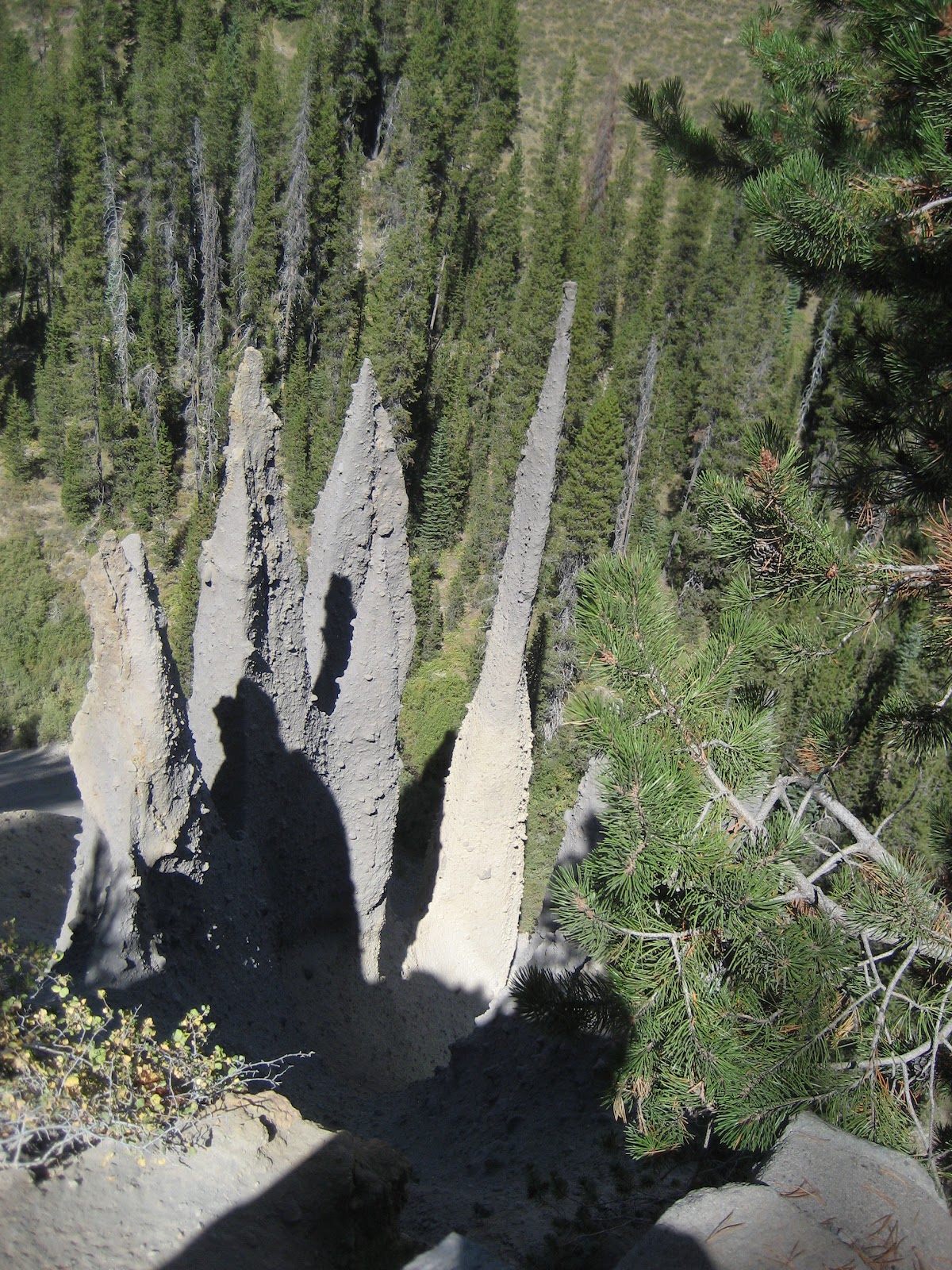
The Pinnacles are a geographic phenomena I have never seen before.  The look almost like the tall chimneys of an elfin village that were formed by lava and rock and steam interacting to allow the steam to rise to the surface.  Shawna, you may need to do a little research on this for your students.

On the drive back from the Pinnacles I was on the inside lane, against the mountains.  Much better. Many bicyclists shared the road, straining to make it over these mountains.

After a few hours at Crater Lake, I drove on to Grants Pass to spend time with friends.  Along the way I came to the Rogue River Gorge near Union Creek.  The gorge in places is only twenty-five feet wide, so the water rushes and crashes fast and deep through the rocks.  Above the gorge the river is not all that big and is rather calm, but everything changes when the water is forced into a narrow path among the rocks. I loved the sound of the water even more than view.  It brought back memories of camping beside rushing rivers in my childhood and falling asleep to the river sounds.  Shawna, the lava tube formations in this gorge are another feature for you to research.

So today I have traveled among evergreen covered mountains, clear long lakes, snow-capped peaks, and rushing rivers.  As I get closer to Grants Pass, the trees are more sparse with bald spots in between.

Diamond Peak

Odell Lake and Diamond Peak

Peak near Crater Lake

Crater Lake

Crater Lake

Crater Lake

Crater Lake

The Pinnacles

The Pinnacles

The Pinnacles

The Rogue River Gorge

Lava Holes at the Rogue River Gorge